
Card no 486 – Heinz
A Map of Oberfranken
Country Card Sent From: Germany
Place that Card Sender Lives: near Lichtenfels
Date Received: 6th April 2013
Distance Travelled: 635 miles
Time Taken: 5 days
Postcrossing - DE-2080277

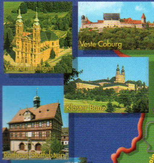
The wording on the front is Cordial Greetings from Oberfranken. There are some lovely building photos on the card.
Oberfranken (Upper Franconia) is a Regierungsbezirk (administrative [Regierungs] region [bezirk]) of the state of Bavaria, southern Germany. It forms part of the historically significant region of Franconia, now part of the German Federal State of Bayern (Bavaria).
With more than 200 independent breweries which brew approximately 1000 different types of beer, Oberfranken has the worlds highest brewery-density per capita. A special Franconian beer route (Fränkische Brauereistraße) covers some of the more popular breweries.
The coat of arms includes: the heraldic lion of Bamberg in the upper left; the black and white pattern of the Hohenzollern family in the upper center; the green crown in bend of the Arms of Saxony in the upper right; the Arms of Franconia in the lower half.

No comments:
Post a Comment
Welcome. I love it when visitors comment - even if it's only to say "Hi, I've been here!"